Distill My Heart Adventures logo

Explore Roads & Streets

Take the road that gives you something to talk about.

Some days call for a highway, some for a city sidewalk, and some for the turn you almost missed. Roads & Streets is our guide to scenic drives, walkable neighborhoods, memorable stops, and getting more out of the miles between here and there.

No bucket-list theater. Just places worth going and better ways to experience them.

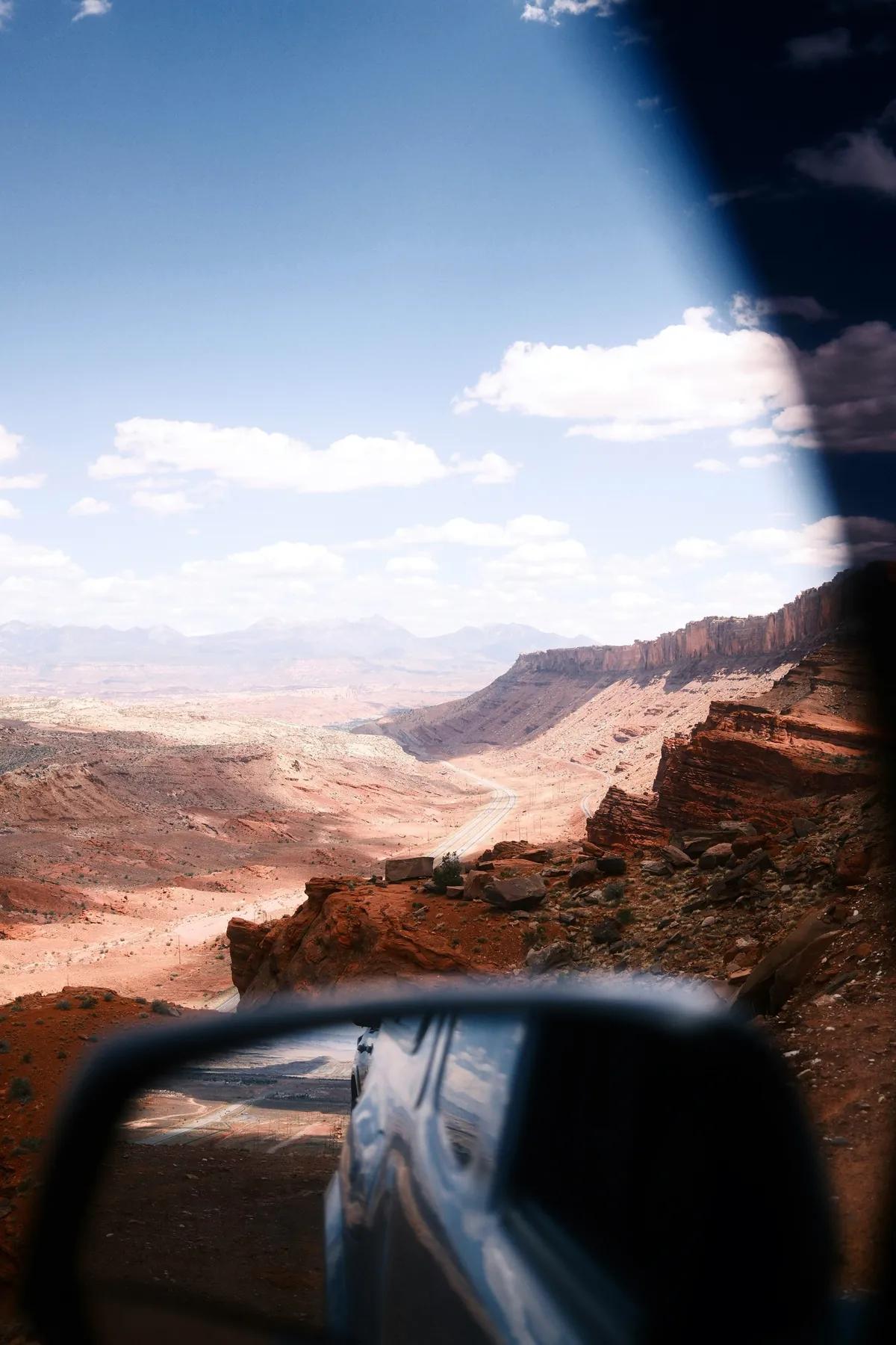
A white SUV following a two-lane road between sunlit red-rock walls near Moab, Utah
Moab, Utah · Photo by Logan Weaver

Choose your direction

Start with the kind of day you want.

A route is easier to choose when you know whether you want open road, a few good blocks, or one excellent excuse to miss the fastest turn.

A white SUV following a two-lane road between sunlit red-rock walls near Moab, Utah

Featured story

The Saturday, Distilled: Take the Long Way

A good day on the road does not require a twelve-step itinerary. Pick a direction, choose two or three anchors, dress like the day matters, and leave enough room for something unplanned.

The point is not to see everything. The point is to remember something.

One anchor, one meal, one optional stop—and enough judgment to know when the day has found a better plan.

8 min read
Read the full story

Routes worth taking

A plan with room to breathe.

Four launch guides, built around real places and practical decisions. Check every verification date and official source again before leaving; roads, fees, access and hours change.

These routes were researched from current public sources. They are not presented as firsthand Distill My Heart Adventures reviews.

A white SUV following a two-lane road between sunlit red-rock walls near Moab, Utah
Scenic DriveCottonwood Heights to Brighton, Utah

Big Cottonwood Canyon to Silver Lake

A close-to-the-city mountain drive with granite walls, creekside pull-offs and an accessible boardwalk at the top when weather permits.

Start
Mouth of Big Cottonwood Canyon on SR-190
Finish
Silver Lake Recreation Area, Brighton
Distance
15 miles one way to Silver Lake
Travel time
Plan about 45 minutes each way before stops; check live canyon traffic
Make a day of it
3–5 hours
Best time
May–October for the boardwalk, subject to weather; fall color draws heavier traffic
Effort
Easy drive; optional 0.9-mile lake loop
The feeling
Cool air, tall rock, creek noise and a genuine change of altitude

Three primary stops

  1. The canyon mouth. Reset the day here: confirm conditions, put the phone away and let SR-190 narrow the view to rock, water and road.
  2. Cardiff / Mill D area. A useful middle anchor for a short creekside pause or trailhead stop. Park only in posted legal spaces and display the required pass inside a posted fee area.
  3. Silver Lake. The Town of Brighton describes the lake as fifteen miles up-canyon, with an accessible interpretive boardwalk open roughly May through October, weather permitting.
Practical details and optional detour

Optional detour: Continue around the Brighton Loop only if parking and traffic are calm. A full lot is a good reason to keep moving and save the walk for another day.

  • Check UDOT’s live Cottonwood Canyons page before leaving; closures, traction restrictions and uphill controls can change quickly.
  • Posted Forest Service recreation fee areas include Cardiff / Mill D and summer access at Silver Lake. The current local pass listed by Brighton is $10 for three days per vehicle.
  • Big Cottonwood Canyon is a protected watershed: dogs and swimming are prohibited. Service-animal exemptions apply under the posted order.
  • In winter, canyon traction rules are stricter than ordinary Utah roads and parking systems may require reservations at resort destinations.

Worth knowing

The road is the main event. Choose one walk, not four; if a trailhead is crowded, the better day may be a slow drive and a long lunch back in the valley.

3–5 hours Last verified

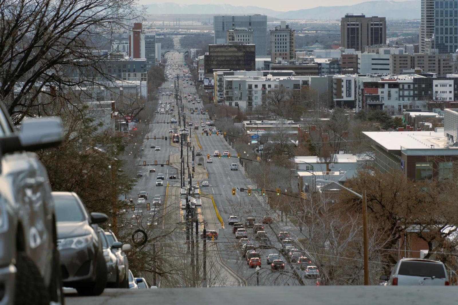
A Salt Lake City street lined with buildings, traffic lights and the Wasatch Mountains beyond
City WalkSalt Lake City, Utah

9th & 9th, Liberty Park and Gilgal on Foot

A flexible Salt Lake City loop connecting an independent business district, the city’s oldest park and one singular sculpture garden.

Start
9th & 9th business district (900 East and 900 South)
Finish
Return to 9th & 9th after Gilgal Sculpture Garden
Distance
About 3.5 miles, depending on the Liberty Park loop
Travel time
75–90 minutes of walking
Make a day of it
3–4 hours with a meal and browsing
Best time
Late morning through early evening; spring and fall are especially comfortable
Effort
Easy urban walk on sidewalks and park paths
The feeling
Local storefronts, mature trees, public art and room to change your mind

Three primary stops

  1. 9th & 9th. Begin around 900 East and 900 South. Browse first, then choose one place to eat rather than trying to turn every storefront into a checkpoint.
  2. Liberty Park. Walk west to Salt Lake City’s oldest and second-largest park. The city lists park hours as 5 a.m.–11 p.m.; the Rotary Playground remains under construction into summer 2026.
  3. Gilgal Sculpture Garden. Continue north to the small public garden at 749 East 500 South, home to twelve original sculptures and more than seventy engraved stones.
Practical details and optional detour

Optional detour: Add the Out of the Blue whale sculpture at the 1100 East roundabout, then decide whether the extra blocks improve the walk or merely make it longer.

  • Street parking varies by block. Read posted signs and avoid treating residential driveways or private lots as neighborhood parking.
  • Use marked crossings on 700 East, 900 East and 900 South; these are active city streets, not a pedestrian promenade.
  • Salt Lake City sponsors bus routes 1, 2, 9 and 21 as part of its Frequent Service Network; confirm the current UTA trip plan before leaving.
  • Business hours change often, so choose a meal stop on the day rather than building the route around an unverified opening time.

Worth knowing

This route works because it is adjustable. One good shop, a park bench and a long lunch can be the entire afternoon; Gilgal is there when the day wants one more chapter.

3–4 hours with a meal and browsing Last verified

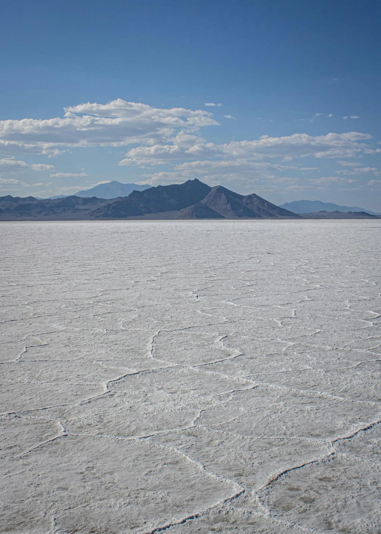
The white surface of the Bonneville Salt Flats stretching toward low blue mountains
One-Day Road TripSalt Lake City to Wendover, Utah

Salt Lake City to the Bonneville Salt Flats

A full-day westbound run across the basin to a landscape that rewards preparation, restraint and a very good pair of sunglasses.

Start
Salt Lake City
Finish
Bonneville Salt Flats access road near I-80 Exit 4
Distance
About 240 miles round trip; BLM places the flats 120 miles west of Salt Lake City
Travel time
Roughly 4 hours total without stops
Make a day of it
7–10 hours
Best time
A dry, clear day; avoid the hottest part of summer afternoons
Effort
Easy walking, but high exposure to sun, wind and heat
The feeling
Big sky, hard horizon and the useful feeling of having gone somewhere

Three primary stops

  1. Great Salt Lake State Park. Use the westbound leg for a lake-level view near Magna. Admission applies; check the park’s current alerts, hours and water access before committing.
  2. Bonneville Salt Flats access. Take I-80 Exit 4, follow signs toward the Speedway and use the paved parking area at the end of Leppy Pass Road. Day use is free outside special events.
  3. Wendover. Refuel both the vehicle and the people before turning east. Choose the meal on the day; verified business hours are deliberately not baked into this route.
Practical details and optional detour

Optional detour: Black Rock at Great Salt Lake State Park adds a short walk and another way to read the basin, but skip it when heat, smoke or current park alerts make the stop less worthwhile.

  • The BLM says there are no facilities on the flats. Carry water, sun protection and enough fuel to reach Wendover comfortably.
  • Never drive onto wet or submerged salt. Seasonal closures are posted, the edge can conceal mud and recovery can be dangerous and expensive.
  • Salt residue is corrosive; wash the vehicle after any permitted drive on a completely dry surface.
  • The BLM lists multiple exclusive-use event periods in 2026, including July 7–13 and July 27–August 8. Check the official schedule on the day you go.
  • Overnight camping and fireworks are prohibited on the salt flats. Personal sightseeing and photography do not require a permit outside restricted event areas.

Worth knowing

When access is restricted, the paved road and designated viewing limit may still offer the better choice. The salt is a protected landscape, not a blank parking lot.

7–10 hours Last verified

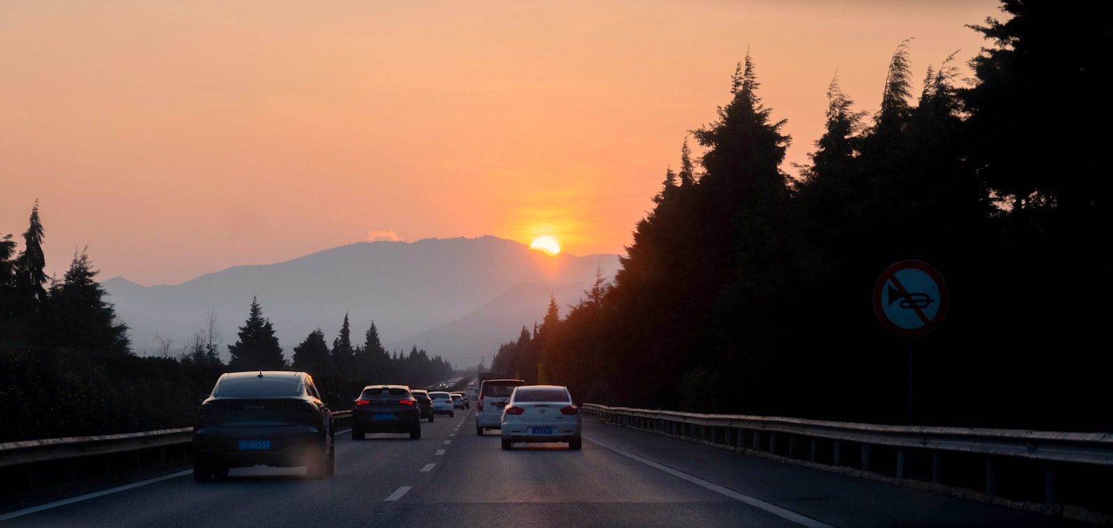
Cars traveling along a highway at sunset
Field GuideAnywhere in the United States

How to Plan a One-Day Road Trip That Feels Like a Day Off

A repeatable route for choosing one anchor, one meal and enough unscheduled room to keep the day from becoming work.

Start
Home, after breakfast
Finish
Somewhere worth sitting before the drive home
Distance
Choose a radius that keeps driving under half the day
Travel time
Aim for no more than 4 hours behind the wheel
Make a day of it
8–10 hours
Best time
Any free day with workable weather and daylight
Effort
Adjustable; include at least one short walk
The feeling
Deliberate without becoming scheduled to death

Three primary stops

  1. One anchor. Choose the view, neighborhood, museum, trail, market or event that would make the drive worthwhile on its own.
  2. One meal. Pick a place connected to the destination, then verify its hours directly before leaving. Keep a second option nearby.
  3. One closing stop. End with a park bench, coffee counter, overlook or early dinner where the day can land before everyone gets back in the car.
Practical details and optional detour

Optional detour: Choose one only after the anchor and meal are working. A detour earns its place by improving the day, not by filling an empty line in the itinerary.

  • Check road, weather and destination alerts on the morning of departure.
  • Download the route for weak-service areas and tell someone your general plan when traveling remotely.
  • Carry water, a light layer and a little cash; verify fuel or charging availability before long rural segments.
  • Build a bad-weather alternative that uses the same town or neighborhood rather than canceling the entire day.
  • If the group is tired, hungry or no longer interested, skip the next stop without holding a meeting about it.

Worth knowing

A successful day trip is not the one with the highest stop count. It is the one whose pace still feels good during the drive home.

8–10 hours Last verified

The deliberate stop

Let every stop contribute to the day.

A good route is not an excuse to collect pins. Stop when the place adds a meal, a walk, a sound or a little more character to the day.

Eat Somewhere Local

Find the diner, counter, market, or neighborhood restaurant that belongs to the place—not the same exit-ramp option available everywhere.

Find a drink or place for later

Walk Before You Leave

Even on a driving day, park the car for a while. A town reveals more at three miles per hour than it does through a windshield.

Try the Salt Lake City walk

Stay for One More Song

When a bar, patio, record shop, or live room has the right energy, the schedule can wait.

Follow the day into Sounds

What to bring

Pack for the Day You Actually Want

Bring enough to stay comfortable and flexible, not enough to turn the trunk into a product catalog.

Dress for the day like you meant to leave the house. Comfort matters, but “comfortable” does not have to mean “gave up.”

  • Water
  • Sunglasses
  • A real camera or a charged phone
  • A light layer appropriate for the destination
  • Comfortable shoes that still look intentional
  • Offline directions for areas with weak service
  • A small cooler when appropriate
  • A little cash
  • A road playlist
  • Enough empty space in the schedule to make a detour

Road music

Give the Miles a Soundtrack

The right playlist changes the distance. Start with Snapbacks & Stetsons, explore the Sounds collection, or choose something built for the particular road ahead.

Cars traveling along a highway at sunset

Flagship playlist

Snapbacks & Stetsons

Country at the center, with enough range for the highway, the city edge and the last miles home.

Explore the Sounds collection

If the player is unavailable, use the direct Spotify link below.

Open Snapbacks & Stetsons in Spotify

When the driving is done

The Last Stop Should Not Be Behind the Wheel

A good route sometimes ends with dinner, a neighborhood bar, or a bottle opened after everyone is home. Explore Drinks or use Whiskey Flight Deck to build a tasting for another day.

If anyone is drinking, they are not driving. Choose a sober driver, safe ride, or save the pour.

Latest from Roads & Streets

Start with a route that already has a point of view.

Launch guides for a mountain road, a city neighborhood, a Utah day trip and the practical art of making an ordinary Saturday matter.

A white SUV following a two-lane road between sunlit red-rock walls near Moab, Utah

Scenic Drive

Big Cottonwood Canyon to Silver Lake

A close-to-the-city mountain drive with granite walls, creekside pull-offs and an accessible boardwalk at the top when weather permits.

Cottonwood Heights to Brighton, Utah3–5 hours
Read this guide
A white SUV following a two-lane road between sunlit red-rock walls near Moab, Utah

Practical Field Guide

The Saturday, Distilled: Take the Long Way

A good day on the road does not require a twelve-step itinerary. Pick a direction, choose two or three anchors, dress like the day matters, and leave enough room for something unplanned.

Back roads and city blocks8 min
Read this guide

Current routes Every time-sensitive guide shows a verification date and links its sources.

Honest photography Real streets and roads, with creators and licenses recorded.

No invented mileage Unverified details are omitted or clearly framed as planning advice.

The Distill My Heart Adventures newsletter

Put Something on the Calendar

Occasional routes, neighborhood finds, seasonal drives, and ideas for getting more out of a free Saturday.

    No clutter, no selling your address. Unsubscribe whenever you like.

    Built with Kit